
Czechoslovakia in American nuclear target plans
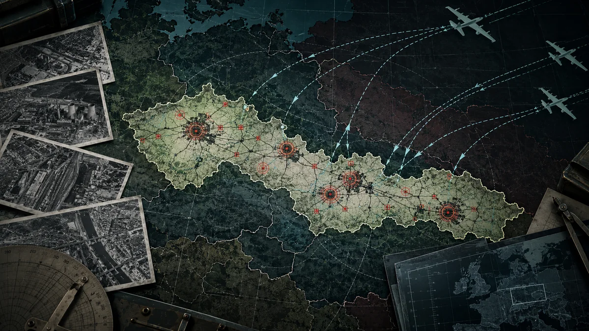
Interactive archive map
Points use period coordinates of SAC. Click to open the original name, priority and direct link to a specific page of the undisclosed PDF.
Map Base: OpenStreetMap. The position of the points is derived from the numerical coordinates given directly in the SAC documents. The accuracy is therefore consistent with the historical planning background, not the current geodetic accuracy.
2. What was the SAC study for 1959
SAC Atomic Weapons Requirements Study for 1959 It was created in June 1956. Its title and introductory part published by National Security Archive identifies it as a strategic air command planning study focused on demands for a general war in 1959.[2] The undisclosed file has hundreds of pages and was originally made up of large tables. When the National Archives were unveiled, the tables were scanned and converted into sheets of a normal format, which explains their difficult reading and some ambiguities in the transcription of names.
The planning was divided into several layers. The priority was the objectives of the adversary's ability to wage air and nuclear war - airports, air bases and associated infrastructure. The next layer was called Systematic Destructionwhich worked with urban and industrial capacities. National Security Archive has pointed out that the study contains more than 1,100 airports and over 1,200 urban-industrial complexes; in the "restricted allocation" section, 1,209 DGZ is mentioned.[1][3]
So it's not one "city-one bomb" table. One complex can have several DGZ, several additional sites and dozens of coded target categories. This is why the original document is more important than the later lists on the Internet: without context, the main complex, satellite item, airport and specific DGZ can be confused very easily.
3. How to read Tables: DGZ, Complex, Priority and Codes
We keep four different things separate in the map. Period name is the transcription exactly as it appears in the American table - for example PRAGUE CZECH or PRAGUE/KBELY, CZECH. Modern identification the indicative current location designation is indicated. SAC coordinates are numbers directly from the table, for example 5005-01425which we read here as 50 ° 05 ′ N and 14 ° 25 ′ E. And finally, Priority is the numerical order given for the main items in the list.
This is also why the map does not move historical points to today's centre of the airport or city hall. For example, if we replaced the original SAC point for Kbels with today's GPS coordinate of the airport tower, we would create an accuracy that the primary document itself does not provide. The historical map is meant to show a document, not "correct" it as expected.
The separate list of SAC categories is key for the interpretation of tables. Code 208 means: Government Control Centres, 240 Air Force Command, 245 Air Force warehouses, 248 military crews, 280 seaports, 290 railway bridges - and code 275 stands for POPULATION.[5] Codes are not just a legend of a modern author; they are directly part of the same undisclosed file.
4. Why Czechoslovakia was in the target system
In 1956 Czechoslovakia was an industrially developed member of the Warsaw Treaty, geographically inserted between Soviet military space and the western border of the block. Therefore, the strategic importance was not a single feature. The country had a heavy and armed industry, a dense rail network, military airports and communications nodes, and it was lying right in the space through which forces would be shifting in the European war.
The classified documents allow this general description to be specified. In the urban-industrial list we have directly verified the main complexes such as Prague, Brno, Bratislava, Moravia Ostrava, Plzeň, Česká Lípa, České Budějovice, Dobšiná, Písek, Poštorná / Břeclav, Prešov and Příbram for this version of the map. Some of them have satellite points attached: Prague complex includes Beroun, Kladno, Kralupy nad Vltava, King's Court, Neratovice, Writing, Radotín, Salt, Štějovice and Velvary.[4]
This structure is important. "Prague" in the table does not mean only the city centre; it is a complex with its own central point, several flights DGZ and a wider network of items in the industrial and transport surroundings. Similarly, Moravian Ostrava is a complex connected with Bohumín, Lower Suchou, Noorachin, Hrušov, Karvini, Kovrničí, Place and Studečka.
5. Urban- industrial list: what we really see
Prague has a priority in the verified table 58 and complex 6493. Brno is listed as priority 152, Bratislava 157, Moravian Ostrava 160 and Plzeň 167. Česká Lípa has priority 259, Poštorná 379, České Budějovice 428, Dobšiná 548, Brezno 693, Prešov 931, Příbram 932 and Sísek 1083. The numbers are taken from specific pages of the primary PDF and the map allows each of them to be opened directly.[4]
The lower number in the target list means higher order in the given priority system, but it is not reasonable to mechanically convert them to a simple sentence of the type "Prague would be 58. bomb. " The priority is the item in the table planning system, while the actual sequence of attacks would depend on the operational plan, available media, previous strikes and current situation.
6. Airport: Czechoslovak items directly in SAC Part II
Airfield layer may no longer stand on the secondary article. Primary Part II Restricted Allocation can be read directly for example Bechyni, Bratislava / Ivanka, Brno and Brno / Tuřany, Čáslav / Chotusice, České Budějovice, Dobřany, Holešov, Košice / Barcu, Milovice, Mimoň, Pardubice, Piestany, Praha- Kbels, Praha- Ruzyne, Praha- Vodochody and Přerov. We have manually paired these lines with the pages of the undisclosed PDF for the data layer.[3]
The Prague Trinity is particularly graphic. On the same page appear PRAGUE/KBELY, PRAGUE/RUZYNE and PRAGUE/VODOCHODY, each with its own point and a number priority. This shows why it is inaccurate to speak only of "Prague as a single goal." Strategic planning worked with functions and specific infrastructure within the same agglomeration.
For some airports, the right-hand column is a letter, such as R, S or T. The map keeps it as raw SAC field and does not attach editorial importance to it unless it can be safely derived from the legend of the relevant table. A thorough map should rather admit unundefined code than produce a convincing but flawed interpretation.
7. Category 275 - POULATION: what it means and what it does not mean
One of the most sensitive findings of published documents is category 275. The SAC code list clearly defines it as POPULATION.[5] Code 275 is also visible on the Czechoslovak website - for example in Bratislava and Brno and in a variety of other urban-industrial items.
That's a significant historical fact, but it needs to be formulated accurately. The presence of 275 in the list means that the population was one of the explicitly registered target categories of the complex. However, it does not say in itself that a specific DGZ has been selected exclusively to kill as many people as possible. The same complex may also contain industrial, railway, energy and military categories. For legal and historical interpretation, therefore, we must read individual tables together with doctrine, not isolated code.
National Security Archive has however pointed out that the explicit use of "Population" as a target category shows a very broad concept of strategic destruction which is difficult to match with the idea of a purely military counter-force attack.[1]
8. Prague as a case study
The Prague complex is listed as 58 6493 PRAGUE CZECH with centre coordinate 5005-01425. The same page shows additional flights DGZ, for example A, AB, AC, B and L. The following pages describe a long list of categories and associated sites; they are also explicitly listed Beroun, Kladno, Kralupy nad Vltava, King's Court, Neratovice, Writing, Radotín, Salty, Štějovice and Velvary.[4]
The separate airfield section shows Prague-Kbels with priority 273, Prague-Ruzyně with priority 489 and Praha- Watercourses with priority 541 on one page.[3] The overlap of these two source layers shows the density of the target geography around the metropolis: the urban and industrial complex is not identical to the airport objectives, but the physical effects of individual explosions, of course, do not follow the limits of the tabular categories in a nuclear attack.
Therefore, it would be misleading to draw around each point any "death circle" without knowledge of the assigned weapon, blast height and meteorology. This map deliberately visualizes only what the archive actually provides: the target points, their relationships and source provenance.
9. Thermonuclear recovery and fall problem
National Security Archive, in its analysis, points out that Air Power targets were also associated with thermonuclear weapons in the order of 1.7 to 9 megatons in planning and that ground detonations were envisaged to ensure the destruction of harder targets. Such use increases the amount of radioactive material being sucked into the cloud and thus the risk of a large fall.[1]
It's not right to compare a megaton weapon to Hiroshima by simply multiplying the radius of destruction. Physical effects do not grow linearly with recovery. Yet the difference in energy is crucial, and in a densely populated Central European area, several current interventions would mean not only immediate pressure and heat damage, but also the collapse of transport, energy, health and supply.
Moreover, the fallout is not limited to the state border. The direction of contamination depends on the meteorology at the moment of the explosion. Thus, the hypothetical ground detonation in Czechoslovakia could affect neighbouring countries and, as well, the territory of Czechoslovakia could be affected by a fall from hitting targets in Germany, Poland, Hungary or the Soviet Union.
10. Eastern Europe was to be "saved" in part - but relatively
The documentation distinguished between the Soviet Union and the satellite states for political and psychological reasons as well. National Security Archive states that a number of Eastern Europe targets were considered to be lower yields than those in the USSR. However, the exception was the high priority Air Power targets, where very high recovery could have been used.[1]
The word "save" must therefore only be understood relatively. Moreover, the lower yield of a nuclear weapon may still mean massive destruction and civilian losses, and the high-priority airport in the Czechoslovak space did not have to benefit from this restriction. The JCS document of July 1956 also shows that there was coordination of responsibility for the objectives of Eastern Europe, particularly airports and ports, between the US and the Allied Commanders.[7]
11. The planning document is not a decision to start a war
A secret study shows that the American military institution prepared target demands for a general war. It does not show that the United States Government decided in 1956 to invade Czechoslovakia, nor that all the items mentioned were subsequently taken over without change in the final operational plan.
This resolution is not a word-teller. Nuclear headquarters had to plan before any crisis occurred; at the same time, target files, weapons and doctrine were rapidly changing. In addition, in the late 1950s, duplicated the various American components were dealt with, and this was one of the impulses for later creation of integrated SIOP. The 1956 study is therefore a very strong evidence of the way in which strategic thinking and the objectives are preparedNot the time capsule of a single unchanging command.
12. Other page: Czechoslovak Plan of the Warsaw Treaty 1964
The historical picture would be incomplete if US tables were presented as the only nuclear plan of the European Cold War. Wilson Center published a classified Czechoslovak plan from 1964, prepared under the Warsaw Treaty. The document assumed that, after NATO's initial attack, the forces of the Eastern bloc would quickly move into the offensive towards Western Europe and that nuclear weapons would be routinely used by both parties in the operation.[8]
These documents do not create perfect symmetry - they were created at a different time, for other operational roles and under different conditions. But they allow an important adjustment to the perspective: military planning of both blocks envisaged the possibility that the European war would grow into widespread nuclear destruction. Czechoslovakia was not only a potential target; its army was also part of the Warsaw Treaty's war plans.
13. Civilian population and war law
The classified lists raise the legal question in particular where the urban infrastructure is overlapping with an explicit category Stock. The principle of distinction between military targets and the civilian population was not unknown in the 1950s, but today's codification of international humanitarian law was gradually established and later contractual texts cannot be applied mechanically to each of the 1956 planning decisions.
The factual level can be more clearly defined: the document has worked with extensive systematic destruction of urbanised and industrial centres and some complexes contain the category "Population." To evaluate a specific planned strike legally would require knowledge of the military target, the expected civil effect, the choice of weapon, the available alternatives and the legal framework applicable to the situation. The map does not therefore award legal labels to individual points; it provides documents that can be checked against the primary document.
14. What would the implementation of a comprehensive plan mean for Czechoslovakia
The exact number of victims cannot be calculated from the table. A specific selection of targets actually used would be missing, the yield of each warhead, the height of detonation, the time of attack, the weather, the warning of the population and the state of infrastructure after previous blows. Any one effective number without a model would therefore be rhetoric rather than analysis.
But the qualitative conclusion is robust. Contemporary attacks against airports, hubs, industrial complexes and large cities would hit a very connected network. Even locations that would not be bombed directly would experience power outages, railways, health, telecommunications, supplies and government. In addition, the effects of multiple attacks would overlap in a small and densely populated Czechoslovakia.
In this sense, it is possible to use the sentence that "Czechoslovakia in its then-existing form would cease to function" if we see it as a description of the collapse of modern state and economic infrastructure - not as a claim that the archive proves a plan to physically kill every citizen.
15. Map Methodology: how we rewrote the data
The data layer of this version contains 67 points. All are marked as Primarybecause their line or complex has been visually verified directly in the undisclosed PDF National Security Archive. This is not about the claim that it is a complete list of all Czechoslovak DGZ in all US plans. It is a controlled cut from a particular study of the 1956 SAC, which can be gradually expanded.
At the urban-industrial table we rewrote the main complexes and unambiguously readable satellite locations on specific sides. At the airfield table we rewrote the Czechoslovak lines directly from the scans. Each item shall include:
- American period registration of the name;
- today's location identification;
- the historical SAC coordinate;
- priority, if indicated;
- the complex number or parent complex;
- the exact PDF page and direct link;
- the level of evidence and the date of the check.
We don't use modern localization to shift points. The exception is not Koterbach: today's Rudňany are identified by local historical documentation, but the point on the map still uses SAC coordinate 4853-02041 1956.[9] Similar ANDELSKA CZECH corresponds to the Angel Mountain near Chrastav; even here geometry remains true to the number in the SAC table.[10]
Audit table of points
The table is deliberately static, so source links remain available even when the user turns off JavaScript or no map base is loaded.
| Modern location | Period name | Type | Priority | SAC coordinates | Primary resource |
|---|---|---|---|---|---|
| Bratislava | _ | Main Complex | 157 | 4809-01709 | PDF 27 |
| Brezno | _ | Main Complex | 693 | 4849-01939 | PDF 29 |
| Dubová (Kreis Brezno) | DUBOV CZECH | Satellite | — | 4849-01926 | PDF 29 |
| Podbrezová | THE CZECH SUPERVISORY | Satellite | — | 4849-01932 | PDF 29 |
| Tisovec | TIISOVEC CZECH | Satellite | — | 4841-01957 | PDF 29 |
| Brno | BRNO CZECH | Main Complex | 152 | 4912-01639 | PDF 30 |
| Adamov | ADAMOV CZECH | Satellite | — | 4918-01639 | PDF 30 |
| Blansko | BLANK CZECH | Satellite | — | 4922-01640 | PDF 30 |
| Chicken | KURIM CZECH | Satellite | — | 4918-01632 | PDF 30 |
| Celebrations | _ | Satellite | — | 4908-01620 | PDF 30 |
| Bruntal | BRUNTAL CZECH | Main Complex | 1149 | 4959-01727 | PDF 30 |
| Czech Lip | _ | Main Complex | 259 | 5041-01432 | PDF 39 |
| The Angel Mountain (Chrastav) | _ | Satellite | — | 5048-01458 | PDF 39 |
| Liberec | _ | Satellite | — | 5046-01503 | PDF 39 |
| Mizz | _ | Satellite | — | 5039-01444 | PDF 39 |
| Young Bloslav | _ | Satellite | — | 5025-01455 | PDF 39 |
| České Budějovice | _ | Main Complex | 428 | 4858-01430 | PDF 39 |
| Myslovores | _ | Satellite | — | 4905-01421 | PDF 39 |
| Conquered | _ | Main Complex | 548 | 4849-02022 | PDF 61 |
| Rudňany (period Koterbachy) | COTERBACHES CZECH | Satellite | — | 4853-02041 | PDF 61 |
| Poprad | _ | Satellite | — | 4903-02018 | PDF 61 |
| Ostrava (Moravian Ostrava) | MORAVIA STRAIN OF CZECH | Main Complex | 160 | 4950-01817 | PDF 164 |
| Bohumin | BOHUMIN CZECH | Satellite | — | 4955-01820 | PDF 165 |
| Lower Dry (today part of Havířov) | DOLNI SUCHA CZECH | Satellite | — | 4949-01826 | PDF 165 |
| Noise | _ | Satellite | — | 4954-01810 | PDF 165 |
| Hrušov (now part of Ostrava) | _ | Satellite | — | 4952-01817 | PDF 165 |
| Carvines | CARVINNA CZECH | Satellite | — | 4950-01829 | PDF 165 |
| Capsicum | COPIRISM OF CZECH | Satellite | — | 4936-01809 | PDF 165 |
| Place (today Frydek-Place) | _ | Satellite | — | 4940-01820 | PDF 165 |
| Study | ENGLISH STUDENT | Satellite | — | 4944-01805 | PDF 165 |
| Sand | _ | Main Complex | 1083 | 4918-01408 | PDF 203 |
| Plzen | _ | Main Complex | 167 | 4945-01322 | PDF 205 |
| Postal (today part of Breclav) | POSTON OF CZECH | Main Complex | 379 | 4845-01652 | PDF 208 |
| Breclav | _ | Satellite | — | 4845-01654 | PDF 208 |
| Hodonin | _ | Satellite | — | 4851-01707 | PDF 208 |
| Prague | PRAGUE CZECH | Main Complex | 58 | 5005-01425 | PDF 209 |
| Beroun | _ | Satellite | — | 4957-01404 | PDF 211 |
| Kladno | _ | Satellite | — | 5009-01407 | PDF 211 |
| Kralupy over the Vltavou | COLLECTIONS OF THE VARIOUS CZECH | Satellite | — | 5014-01418 | PDF 211 |
| The King's Court | KLOLUV DVUR CZECH | Satellite | — | 4957-01403 | PDF 211 |
| Neratovic | _ | Satellite | — | 5016-01431 | PDF 211 |
| Entries | CZECH PSARAS | Satellite | — | 4955-01430 | PDF 211 |
| Radotín (today Praha- Radotín) | RADOTIN CZECH | Satellite | — | 4959-01422 | PDF 212 |
| Salty | _ | Satellite | — | 5014-01405 | PDF 212 |
| Chestnuts | _ | Satellite | — | 4951-01424 | PDF 212 |
| Velvary | _ | Satellite | — | 5017-01415 | PDF 212 |
| Prešov | PRESOV CZECH | Main Complex | 931 | 4900-02115 | PDF 212 |
| Ticket | PRIBRAM CZECH | Main Complex | 932 | 4941-01401 | PDF 212 |
| Juniper berry | OTHER CZECH | Satellite | — | 4946-01358 | PDF 212 |
| Beggar | _ | Satellite | — | 4952-01354 | PDF 213 |
| Bechýne - airport | BECHYNE, CZECH | Airport | 463 | 4917-01430 | PDF 4 |
| Bratislava-Ivanka - airport | BRATISLAVA / IVANKA, CZECH | Airport | 438 | 4810-01712 | PDF 5 |
| Brno - airport destination | BRNO, CZECH | Airport | 390 | 4911-01640 | PDF 5 |
| Brno- Turany - airport | BRNO / TURANES, CZECH | Airport | 441 | 4909-01642 | PDF 5 |
| Čáslav / Chotusice - airport | CASLAV / CHOTUSIES, CZECH | Airport | 464 | 4957-01523 | PDF 6 |
| České Budějovice - airport | _ | Airport | 229 | 4857-01426 | PDF 6 |
| Dobranany - airport | GOOD, ENGLISH | Airport | 259 | 4940-01316 | PDF 9 |
| Holešov - airport | HOLESOV, CZECH | Airport | 868 | 4919-01734 | PDF 12 |
| Kosice-Barca - airport | COSICE / BARCA, CZECH | Airport | 446 | 4841-02114 | PDF 17 |
| Milovice - airport | _ | Airport | 376 | 5024-01456 | PDF 23 |
| Mizz - airport | _ | Airport | 492 | 5037-01444 | PDF 23 |
| Pardubice - airport | PARDUBICE, CZECH | Airport | 383 | 5001-01544 | PDF 28 |
| Piestates - airport | PIESTANES, CZECH | Airport | 889 | 4817-01750 | PDF 29 |
| Prague-Kbels - airport | PRAGUE / KBELS, CZECH | Airport | 273 | 5007-01433 | PDF 29 |
| Prague - Ruzynne - airport | PRAGUE / RUZYNE, CZECH | Airport | 489 | 5006-01417 | PDF 29 |
| Prague / Watercourses - Airport | PRAGUE / WATER, CZECH | Airport | 541 | 5013-01424 | PDF 29 |
| Přerov - airport | PREROV, CZECH | Airport | 138 | 4926-01724 | PDF 30 |
16. Conclusion: the greatest force of these documents is their specificity
The undisclosed SAC tables do not say that the United States "intended to eradicate Czechoslovakia without any reason." They say something more historically specific: in the scenario of a general war with the Soviet bloc of strategic planning, the dense network of Czechoslovak airports, industrial areas, transport hubs and urban complexes were included. Some tables explicitly work with the "Population" category and high priority targets could be associated with high-yield thermonuclear weapons.
Equally important is what the archive does not say: the item on the list is not proof that the item has to be affected in each scenario, and the study is not identical to the President's final order. If we keep both of these facts at the same time, we don't need any softening official phrases or any other abbreviations. The documents are sufficiently serious in themselves.
An interactive map is designed to put this principle into practice. The reader may not trust the author of the article: he can click on Prague, Kbels, Bratislava or Přerov and open directly the page of the document from which the point was overwritten. That's how archival publicity is supposed to work.
Resources and primary documents
- National Security Archive: "U.S. Cold War Nuclear Target Lists Declared for First Time, "Electronic Briefing Book. Open Source.
- SAC Atomic Weapons Requirements Study for 1959: Title Page, Table of Contents and Introduction, 15 June 1956. Archive record.
- SAC Part II Restricted Allocation: 1,209 DGZs with airfield list and weapons. Archive record · PDF.
- SAC Urban- Industrial Target List, Part I. Archive record · PDF.
- SAC Category Code List. Code 275 = Population and other categories. Archive record · PDF.
- SAC Part I Complex List with Weapons- complete list. Archive record.
- Joint Chiefs of Staff: "CINCEUR / SACEUR 1959 Atomic Weapons Requirements Studies," 3 July 1956. Archive record.
- Wilson Center / Cold War International History Project: "Secret Plan for Nuclear War in Europe '- the Czechoslovak Plan of the Warsaw Treaty of 1964. Open Source.
- Redňany village: the history of the village and the previous name Koterbach. Open Source.
- City of Chrastav: The Angel Mountain. Open Source.